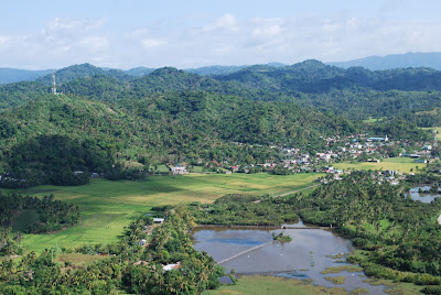
My job as a Public Affairs Officer of the Army's 9th Infantry Division had brought me to various places all over the Bicol Region for two years. I captured these aerial photos during my trip from Pili town, Camarines Sur to Virac, Catanduanes.
As the chopper started to ascend, I took this photo of Mt Mayon, as seen from treetops near our camp.
I took this photo over Ocampo town, Cam Sur. Mt Mayon is aligned with Mt Asog (middle) and Mt Iriga (right most). Look who is the fairest of them all!
This is the foot of Mt Isarog, if you're in Ocampo town. The clearing that you can see is part of the deer farm of CamSur.
As we approached Tigaon town heading towards Sagnay, I took this beautiful photo of Mayon over the clouds. The Philippine Daily Inquirer made this as a banner photo in one of their issues.
When we started crossing the narrow channel of Lagonoy Gulf that separates Goa Camarines Sur and San Andres town, Catanduanes, I took this photo of Mt Mayon from that position.
This is another photo of Mt Mayon as seen from the rugged terrain of Virac town.
My beautiful country!
As we travelled along the coastlines of western Catanduanes, I took these photos.
The town of Caramoram, Catanduanes
Pajo river
When we landed in Virac town, I met some friends who share the same passion----photography. One of them is Engr Fernan Gianan of the Philippine Daily Inquirer. As they say, "Birds of the same feather, flock together".


I really love to see you pictures sir, for i was able to walk on those places when I was assigned in Bicol region, indeed it is one of the many beautiful places in our country. Thank you for posting those pictures.
ReplyDelete